
How to use Yard Checker
☆Yard Checker is an app called "Web application" that you can use without downloading.
☆It's completely free.
∗ This web application was just published in September 2020. If you have any problems or requests, please contact us.
Currently, only personal mode can be used.
How to use Personal mode
Each player can find the positions of the green from the satellite image on google maps, and set the greens as the target to measure distances.
Targets (green positions) can be set during play, but it is convenient to set them at home beforehand.
You can register on Private mode (for pre-registration) in advance.
1. Tap current position button
First of all, when you arrive near the tee ground of the 1st hole, please tap "CurrPos" button.
You can get your current position by using the GPS of your smartphone.
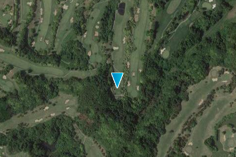
2. Find the green
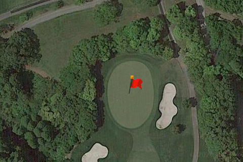
Next, find the green of the 1st hole from the satellite image of google map. You can tap it to set as the target.
(∗ If you have pre-registered, the marker is displayed on the green, so tap the marker.)
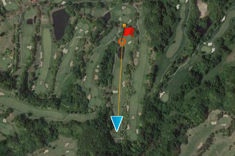
3. Measure distance
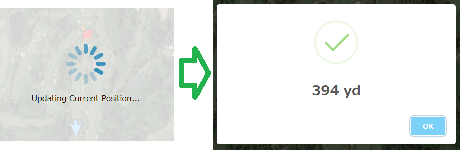
Just before the shot, you can see the distance from the ball position to the target (green) by tapping the "Measure" button.
It is not necessary to tap the "CurrPos" button before because the current position is updated at the same time when the "Measure" button is tapped.
4. Repeat
The target remains set even after measuring the distance, so you can see the distance by simply tapping the "measure" button at the second shot, the third shot and more.
When you arrive near the tee ground of the next hole, repeat from "1. Tap current position button" again.
Normal mode
The position data set in personal mode is automatically sent to the data server, and by accumulating that sent data, each individual player can set the targets (green positions) without having to set it in advance.
Currently, it has just released, so you can not see target information (green positions) in normal mode, but it will be available eventually.
The normal mode can also be used free of charge, so please use the personal registration mode until the data is accumulated and you can refer to target information (green positions).
Please be assured that the data sent to the server is the location information necessary to calculate the green position.